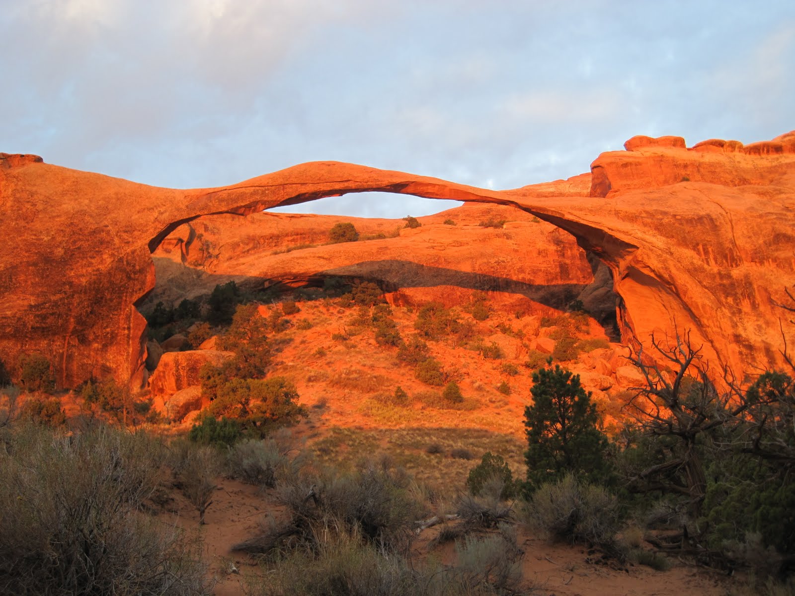
Arches contained, you guessed it, around 2000 natural rock arches in a many coloured desert landscape. We arrived late, but the full moon illuminated the huge rock formations encircling our sought after campground. A 5am start ensured we arrived at Landscape arch just in time for sunrise, wowsers. We then packed up our tent (no. 6 in a series of 19 pack ups, - still always accidentally packed something inside the tent) and headed off on one of the many hikes.
 |
| Crusty crust! |
A word on 'hikes' in national parks. US citizens are not always known for their svelteness (no sniggering, Canada and UK aren't far behind). The Parks service recognises this and understandably doesn't want too many coronaries so the 0.3mile tarmacced walk to a sight is INVARIABLY described as a "hike". Which makes it tricky to distinguish between a stroll and an actual lung busting, tendon aggravating hike. (Rest assured, we found plenty of the latter.)
A ranger led 'hike' through the complex Fiery Furnace left me obsessed with desert crust; tiny bacteria bond together sand grains to, over around 100 years, create soil in which plants can grow. Destroyed by a single footstep, it takes another century to reform; understandably not realised by early European settlers who couldn't fathom why their cattle quickly desolated what appeared to be dry but sustaining grasslands.
 |
| Jumping photo! |
A night in the adventure mecca of Moab preceded our next campspot in Canyonlands NP. A huge distant lightning show and an incredible overlook over the very complex terrain of this park made up for the lack of water tap and stinky toilets. The only real way to explore is a multi day guided jeep or mountain bike trip (or if you don't mind risking a limb or two you could go solo aka Aron Ralston in 127 hours).
Our tattered western states map was becoming unreadable but we found a gem of a replacement; the National Geographic adventure atlas in a Visitor Centre (yes, we did visit lots and yes, I did have to be torn away). We followed a scenic highway route through the lunar like landscape of Grand Escalante National Monument and had a bonus stop at our fifth NP, Capitol Reef, named for the huge fold of the earth's crust rearing up like a reef.
 |
| Bryce Canyon: It really is that good |
Our final 'amazing rock formation' park was Bryce Canyon; not really a canyon (formed by a river) but a series of giant amphitheatres along a high plateau. A sunset hike among the salmon pink rock spires (named hoodoos after voodoo) was breathtaking (particularly as the park is based at over 2,700m elevation). However, it shouldn't surprise you the speed with which a mention of a new species in a park newspaper could give me a deep longing to spot one; the trip could now not be complete without seeing a rare Utah prairie dog (think more meercat than wolf)... A wrong turn on the way out rescued me from despondency as we spotted two little sentries on duty for the colony. Job done.
Now we headed south again for a real hike: to the bottom of the biggest gash in the earth's surface, the Grand Canyon...
No comments:
Post a Comment