Saturday 8 December 2012

Fall in Vancouver: Rain, placards, pancakes... and a bit more rain


Summers are long, sunny and dry in Vancouver and this one lasted well into October.  After getting back from our States road trip we had plenty of time to hike in the local mountains, show our friend Lucy the local celebrity wildlife and 'out-camp' the Provincial Park system by camping after it had technically closed (who needs running water anyway?).
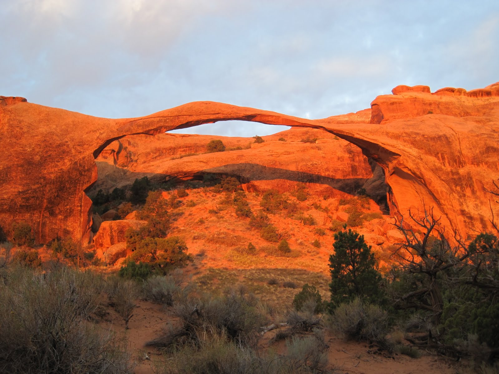
Our penultimate trip to Garibaldi lake


But, on the day our friend left, the heavens opened.  Eight weeks of pretty consistent rain followed, sometimes heavy, sometimes light, sometimes just showers; but definitely water falling from the sky.  Now we're past the 40 day mark, I am wondering whether it might be sensible to commence arc construction...


Anyway, enough whingeing. Without the outdoors not exactly out of bounds, just a bit less fun, what have we been up to?


Good ol' leftie activism

notankers.ca loonie
Neat stickers to put on dollar coins
Canada has one of, if not the, most incredible and pristine landscapes left in the world.  Unfortunately some of it has immense amounts of very dirty, sticky and difficult-to-extract oil in the form of 'tar sands' beneath it. Our next door province, Alberta, fancies itself as the Canadian Texas and wants to sell all its tar sands to China as fast as possible.  To get the oil there, they want to construct a pipeline across British Columbia through the 'Great Bear rainforest' to the coast north of Vancouver.  Tankers the size of the Empire State Building would then navigate the very complex coastline with several hairpin bends through fjords to collect the oil.

It did have writing on...
The experts think a spill is pretty much inevitable, and the environmental and human consequences would be huge (think Exxon Valdez multiplied).  So I've been writing lots of letters, attending company sponsored information sessions to ask awkward questions and waving my (not very pro!) homemade placards at one or two rallies.  It is heartening to see that the city that gave birth to Vancouver has not yet lots its radical streak.  The mainstream media's messaging has swung pretty much 180 degrees and now the pipeline deal looks less and less likely, so here's hoping...

Raising cash

Child poverty is alive and well in British Columbia; one in five under six year olds live in poverty.  A national/local charity 'United Way' coordinates a huge fundraising campaign every fall to raise money to prevent child poverty, bullying and social isolation of seniors.  It has clear goals and excellent fundraising resources for its corporate partners, including my employer.  

Our coins overwhelmed the machine...
I used them to helped organise our annual campaign, kicking off with the favourite North American fundraising staple; a 'Pancake Breakfast', then cookie competitions, online auctions and, my favourite, a slightly menacing Superman cut out with our President's face which you had to pay to have removed from your office. 

I (hopefully tactfully) encouraged the fundraising committee to become more results focussed and also overhauled the communications to lead with cost examples and case studies.  I was pretty chuffed that the number of staff who pledged (either one off or monthly) went up by 35% and we increased our cash intake by 10%. Hopefully a strong platform for next year. 

Serving time in the gym

I'm getting there...
Never been a big gym goer, preferring life outdoors, but in an effort to finally beat my achilles problems and get strong for skiing, I've hit the gym in a big way.  Got myself a programme from a strength and conditioning coach and work on it at least three times per week.  Fingers crossed it works and I'll be back running in January and super strong on the slopes. 


Waiting for snow

Tyto the barn owl
Whistler's had about 10 feet of snow, but the local mountains have had thin pickings... until this weekend.  Just back from our first venture up to Grouse Mountain which had a few runs open and got us nicely warmed up.  Also got to meet my friend Dan's office mascot.

With most of our friends away for Christmas we'll be house sitting for Mark's boss, taking his slightly nervous dogs for walks, watching 'It's a Wonderful Life' and hopefully hitting the slopes.  Have a great holiday season! 


Thursday 4 October 2012

Yosemite, Napa Valley and Mt Rainier: Big walls, expensive grapes and trash TV


Yosemite. Another one of the US National Park biggies.  And, like many of the 'desert parks', defined by rocks but not your wishy-washy-eroded-by-a-bit-of-wind-and-water rocks, but huge kilometre high granite walls carved out by the relentless force of glaciers.

We camped at one of the highest points, Tuolumne Meadows, a sea of meadows and forest amidst smooth domed islands of granites.  We hadn't worried about bears for days but were back on high alert: California's bears have figured out the rich pickings available in vehicles, 1000 are 'beargled' each year - just one paw inserted in the top of the door rips open the entire side to access the loot. On guard at the campground, we weren't expecting one to sprint in front of our car (he crossly safely but I have definitely lost all pretence that I could outrun one).

El Capitan
The nighttime freezing temperatures (we camped at over 3000m) were a welcome relief from the Death Valley heat.  In early morning, we tackled the main valley; its proximity to the major urban centres of California made it the busiest park we encountered.  But, as always, the 'car park effect' worked a treat and we hardly encountered anyone on our 14 mile hike to the back of Half Dome (you can guess the shape of that enormous lump of granite). Crowds do make for creature comforts though so pizza and shower followed.  On our drive home in the dark, we spotted the head torches of climbers settling down for the night mid way through their multi-day climb up some of the kilometre high walls (they sleep on portable ledges strapped to the face and poo in tubes, a bit too rustic even for us).  Next stop: wine country.

Their summer residence
Napa valley, near San Francisco, first started growing vines in the late 19th century. Prohibition pretty much killed the industry and it took until the 60's before they could produce decent wine again.  And it turned out to be very decent indeed, winning gold medals on the international stage at the 1976 Paris Wine tasting competition (snooty European judges needed blindfolds to get rid of their anti-Yank prejudices) and so launching California's wines onto the world stage.  

We camped in the heart of the valley with our American friends, Kathy and Tracy who we met kayaking in Greece. Mark sufficiently impressed various winery tasting room hosts with his vino knowledge to get us some tastes of the good stuff.  And the good stuff was very good but came with hefty price tags: making us realise how good local BC wine - similar quality for around half the price.  It was good to relax for a few days (although 5am starts are fun, they're rarely restful) and we finally perfected our s'More technique (non north americans: google it).

And so to the final weekend.  No bookings made, northern Oregon campgrounds were full so we had our first night in a proper motel complete with microwave dinner and trashy TV (turns out a reality show about constructing fish tanks is actually quite addictive).  Our Nat Geo map showed one more National Park on our way home, the mighty Mt Rainier, a dormant, but definitely not dead volcano.  Plenty of camp spaces, we got in one final hike, back on what felt like familiar ground: pine trees, alpine meadows and glaciers.  A final drive, three border crossings in four hours (to give back our hire car) and we arrived home.  Piles of stuff to unpack, no car, but some awesome photos and instant plans for the next trip.  Roll on ski season!

Monday 24 September 2012

Grand Canyon, Vegas and Death Valley: Early starts, wet t-shirt competitons and flamingoes

5 million people visit the Grand Canyon every year for, on average for 2 hours, and only about 1% make the journey down to the bottom where the temperature can be 20c hotter, rattlesnakes are common and water sources unreliable en route.  With a list of attractions like that, we couldn't resist.

We based ourselves at the less popular North Rim which sits on the higher, cooler, green Kaibab plateau. The canyon is awesome in the true sense of the world and a full moon rising shortly after a fiery sunset certainly didn't detract.  But I’ll admit; we were a bit nervous about the next day.  The park literature makes a summer descent in the heat sound a bit insane and even a little dangerous.  We'd chosen the longer 28 mile route and seemed to have budgeted half the normal time to do it.  The advice was to complete all hiking by 10am so it was an early night...

...followed by an early start; alarm at 4am and we were on the trail by 5.  It took 7 miles to drop to almost the bottom, then another 7 to reach the mighty Colorado river 1000m below the rim.  And actually, it was pretty easy; with only 1 hour not in the dark or shade we arrived at our campground at 11.30.  Plus, it was all downhill, though you knew what goes down must come up....
It was actually pretty comfy
We had no tent, sleeping bags or stove to save weight, (at 38 in the shade we didn't get too cold) and so rigged up a survival blanket for a quick afternoon nap.  Every activity factored in a trip to the river to soak t-shirts in the cold water to try and regulate our temps (it stayed around 50 in the sun all day).  The highlight was an extra 3mile hike at 4pm half way up the South Rim with phenomenal views and another great sunset.  If we hadn't been quite so cautious we realised we could have attempted the Rim to Rim to Rim, but always good to leave a challenge for next time...


A 3am start got us to the top by 10.45 (yes, weirdly it took us roughly the same time to get down and up), but 45min in the full sun was enough for me to feel a bit strange - must be lack of sodium which convinced me to eat a whole tube of Pringles (except for those stolen by a chipmunk after I dozed off).  Pizza, a rare shower and beer completed an awesome trip.  We left the empty green plateau, drove through the empty desert and felt rather surprised to arrive at...
Las Vegas, baby!  If you've been, you'll know how crazy it is if you haven't here's a summary:


Our low key hotel
- they've built the streets of Venice inside a hotel, gondolas on canals on the third floor (I've been to Venice, this was identical but cleaner);
- they've rebuilt Paris, including the Eiffel Tower and the Arc de Triomphe, replete with Gordon Ramsay's face on it, (I've been to Paris, it was pretty similar, but the waitresses were more polite);
- you can gamble wherever you want, whenever you want, whatever you want but we didn't because my great great grandmother (the Countess Voltaira dontcha know) lost all her money gambling in Monte Carlo so I can't touch it; and
- girls, girls, girls are available everywhere ("in your room in 20 minutes") - not nice, now it becomes clear why so many conferences happen in Vegas.

Zabriskie point, Death Valley NP
Awesome to see, but having driven through hundreds of miles of desert it's pretty obvious it's about 200% not sustainable.  In 1000 years humans (if there are any left) will pick over the ruins and hold it as an example that, despite all the technology of the 21st century, we couldn't magic up water. However, it could serve incredibly realistic French food about 8000 miles from Paris so that was a bonus.
And, after 30 minutes of enforced pool time (by me) we headed to our Park 8: Death Valley.  Officially the hottest place on earth, can I admit we were a tiny bit pleased to be in a car with air con?  For some reason, I had forgotten that valleys need mountains on either side, so the 3000m peaks on either side were somewhat of a surprise. 

Don't worry, he came back
We waited until 5pm to do the obligatory walk on the salt flats at the lowest point in the US (the water in Badwater certainly didn't look inviting) but it was still roasty toasty.  And even with my desire to tick everything off from the guidebook, the walk on sand dunes in 46c was too much and I fled to the car.  Our campsite was luckily 2000m higher than the valley floor so not too hot to sleep.  But most excitingly we spotted a newly-discovered-in-the-park-newspaper-species, a tiny, non water drinking, nocturnal kangaroo rat (so inquisitive about our camp spot I nearly trod on him). 

Desert: tick.  Now back to the mountains with the Sierra and the climber’s paradise of Yosemite...

Thursday 20 September 2012

Arches, Canyonlands, Capitol Reef and Bryce Canyon: Hot rocks, cool campsites and scenic byways

So our usual northern evergreens were gradually replaced by rocks, sand and cacti as we drove 600 miles south to four of Utah's national parks.

Arches contained, you guessed it, around 2000 natural rock arches in a many coloured desert landscape.  We arrived late, but the full moon illuminated the huge rock formations encircling our sought after campground. A 5am start ensured we arrived at Landscape arch just in time for sunrise, wowsers.  We then packed up our tent (no. 6 in a series of 19 pack ups, - still always accidentally packed something inside the tent) and headed off on one of the many hikes.

Crusty crust!
A word on 'hikes' in national parks.  US citizens are not always known for their svelteness (no sniggering, Canada and UK aren't far behind).  The Parks service recognises this and understandably doesn't want too many coronaries so the 0.3mile tarmacced walk to a sight is INVARIABLY described as a "hike". Which makes it tricky to distinguish between a stroll and an actual lung busting, tendon aggravating hike.  (Rest assured, we found plenty of the latter.)

A ranger led 'hike' through the complex Fiery Furnace left me obsessed with desert crust; tiny bacteria bond together sand grains to, over around 100 years, create soil in which plants can grow.  Destroyed by a single footstep, it takes another century to reform; understandably not realised by early European settlers who couldn't fathom why their cattle quickly desolated what appeared to be dry but sustaining grasslands.

Jumping photo!
A night in the adventure mecca of Moab preceded our next campspot in Canyonlands NP.  A huge distant lightning show and an incredible overlook over the very complex terrain of this park made up for the lack of water tap and stinky toilets.  The only real way to explore is a multi day guided jeep or mountain bike trip (or if you don't mind risking a limb or two you could go solo aka Aron Ralston in 127 hours).

Our tattered western states map was becoming unreadable but we found a gem of a replacement; the National Geographic adventure atlas in a Visitor Centre (yes, we did visit lots and yes, I did have to be torn away).  We followed a scenic highway route through the lunar like landscape of Grand Escalante National Monument and had a bonus stop at our fifth NP, Capitol Reef, named for the huge fold of the earth's crust rearing up like a reef.

Bryce Canyon: It really is that good
Our final 'amazing rock formation' park was Bryce Canyon; not really a canyon (formed by a river) but a series of giant amphitheatres along a high plateau. A sunset hike among the salmon pink rock spires (named hoodoos after voodoo) was breathtaking (particularly as the park is based at over 2,700m elevation). However, it shouldn't surprise you the speed with which a mention of a new species in a park newspaper could give me a deep longing to spot one; the trip could now not be complete without seeing a rare Utah prairie dog (think more meercat than wolf)... A wrong turn on the way out rescued me from despondency as we spotted two little sentries on duty for the colony.  Job done.

Now we headed south again for a real hike: to the bottom of the biggest gash in the earth's surface, the Grand Canyon...

Wednesday 19 September 2012

Yellowstone and Grand Teton: "Moose-hunting, bear-avoiding and geyser-gazing"

Sniff, sniff
Canadian colleagues were already concerned that our 19 year old many-patched Jeep wouldn't make it 5000 miles through the US deserts in summer. She might have heard them or, more likely, she was concerned for our welfare and knew she wouldn't make it in the real heat so on day 2 she bowed out gracefully.  As the extremely kind Montanan mechanic explained, we could invest hundreds of dollars fixing the radiator to see if the engine was okay but, with sterner tests to come, we bid her farewell on a parking lot in Missoula.  So with just a day lost, we headed off in our new (bizarrely Hawaiian plated) hire car, to Yellowstone.

They know they own the road
Keen readers, or just my mum, will remember we visited the snowy expanses of the USA's first national park at New Year. Trying to catch up our schedule to our achieved-with-blood-sweat-and-tears campground reservations, it wasn't such a leisurely affair this time.  A 4.30am start (don't worry, it won't be our earliest) ensured we didn't miss some magical wolf howling, traffic jams caused  by 2 ton bison and the usual array of speedy antelopes and trotting coyotes. 

Stinky stink
The park is actually the caldera of a huge exploded super volcano and so is one of the most geothermally active places on the planet.  This results in a good stink in some places, yellow stone (geddit?) and some awesome erupting geysers.  We just had time for the main show of 'old faithful' and some bubbling mud before we headed on to our park number 2...


Classic Tetons shot


The Grand Tetons range is still pushing up, while the area around it sinks (into 'Jackson Hole') meaning you get a rare view of an entire range rising from the plains.  We were lucky to have a day of good visibility as all summer humongous forest fires have raged across this part of the States.  But it wasn't all about the peaks, we had one clear objective; to see a moose.  You might think living in Canada would have sorted this already but my constant questioning always resulted in "oh moose, well, they're just everywhere".  Yep, everywhere and NOWHERE!  It was allegedly impossible not to see a moose in GT so the hunt was on....

No. 1 recommended spot (yummy willow trees); no moose.  Second choice (delicious boggy weeds); no moose. Place where nice visitor centre man saw three on his way to work; no moose.  Place fellow moose hunter saw one an hour ago; no moose.  My spirits were sinking. Our last chance was our overnight trip high up the mountainside... 

He owns the forest and he knows it
Armed with specific ranger taught brush observation techniques we set off with some trepidation.  But it turned out the moose gods knew it was my birthday. A polite cough/grunt/neigh sound to our left revealed a set of palmate antlers... success!  And then we couldn't stop seeing them: we followed a lady moose as she travelled amazingly quickly through dense undergrowth; watched a bull moose reclining in meadows and; as we ate our lunch, another bull walked straight across our path (a bit too close for comfort).  So moose panic over.

We camped at a lakeside wilderness site (which means no north American staples like a picnic table, fire ring and pit toilets (in case you're wondering, you go in a hole and pack out the tissue, nice)).  All very tranquil until at 8pm a large black bear nonchalantly approached the camp.  Unlike BC bears he was undeterred by talking, shouting and clapping and only backed off after we banged rocks on the bear cache and Mark made a special, new poltergeist like bear scaring wail (our 6 neighbours seemed slightly perturbed by this development).  But he didn't go far, just circled the camp until he disappeared into the dark trees...

Bit grainy, but you get the idea...
Needless to say, little sleep was had by all, not helped by gale like winds which would have masked his approach (though huge padded feet make them pretty silent).  But we survived the night and then bumped right into him sitting on the path as we left...  When we later made our bear report to the rangers we discovered a hiker had his pack ripped apart by a bear in the same area that day so were lucky (more for not losing our dinner, black bears are rarely too dangerous).  But then that's the challenge of spending time in prime bear habitat.

We left the next day, saying goodbye to the familiar mountains and forests of the north to the deserts and canyons of the south...

Whirlwind tour of the Western States - the intro


Its hard to know where to start with blogging about our 3 week road trip to ten of the most iconic national parks in the US.   We went from 46 degrees centigrade to below freezing in one day.  We walked on the lowest point in the US, and on snow near one of the highest.  And, obviously my fave part, saw wildlife from a 1 ton bison to 20gram hummingbird, and a bear with a very keen interest in our dinner.  Oh, and we wrote off our car (turns out temperature gauges ARE really important after all...)

Instead of one epic post, I'll divide the trip into posts on each park, check out the sub title if the park names don't mean too much...  WARNING:  I've written some of it as much for us to remember all the good, bad and ugly bits: so some of it is pretty long, feel free to skim and just look at the piccies!


Thursday 23 August 2012

The most scenic ultra race in Canada...

19 August has loomed huge on the horizon ever since I clicked 'confirm' on my race entry form for the 30 mile portion of 'the most scenic ultra race in Canada'.  An ultra race is technically anything further than a marathon.  So, if I completed it, I would become part of a growing group of people who love running long distances, normally in the mountains. Pretty much the same group of people I had dismissed as insane when I discovered they even existed last year.

One of the climbs (this one I did remember)
My training went well, really well, for about five months: long runs at weekends on increasingly hilly and technical terrain; speed and hill workouts; and two 25km races on the local North Shore mountains.  Then one of the inevitable endurance injuries set in, Achilles tendonitis and I had to back off training.  Four weeks pre-race, my long run (which still wasn't really long enough) damaged my tibial tendon, which ruled out more more running.  Adding insult (well, I guess injury) to injury, a cycle ride to keep up my endurance pulled out a rib with 7 days to go.

So, many hundreds of dollars on physio later, I was at the start line.  Mark, as always supportive and encouraging, had given me my final pep talk, with varying degrees of accuracy:


  • "you're the fittest you've ever been" - this much was true;
  • "you know the course backwards" - we had hiked it the month before but I'd conveniently forgotten key elements like there being 7, not 4, brutal climbs; and
  • "if you start, you'll finish" - well, this was kind of true, you crossed one road 10 miles in and, if you didn't turn back then it was finish or wait for mountain rescue...

Enough warm-up, what happened in the race?:
The ridge section (on a recce run)


  • Adrenaline is a magical substance.  I didn't notice my existing injuries and wasn't in much pain until mile 22 when both knees went on strike. For the final 8 miles, I mastered a stiff legged, arm pumping jog which was surprisingly effective.
  • Closest I've been to a cougar/mountain lion - at aid station #1 they (accidentally) told me one had been sighted on the trail I'd just run (as well as two surprised bears).  "Lucky it isn't ahead of me" I thought.  Took me 2 hours to remember that cougars don't respect race leg boundaries and start worrying about every twig snapping.
  • I felt incredibly nauseous for about 2.5 hours climbing 1700m.  Meant I couldny eat which slowed me down, but just made the pringles at the 2nd/last aid station even better.
  • I performed really quite effective first aid on cuts sustained in a fall, simultaneously providing much needed food aid to passing moquitoes, and didn't beat myself up too much about losing my sunglasses.
  • I took an extended nature bathroom break. Traumatic. Mosquito ridden. 'Nuff said.
  • I was blown away by the views, the first brutal climb topped out on a magnificent ridge line with the snowy peaks of the Northern Cascade range on one side and acres of alpine meadows on the other. Sufficient encouragement to keep running.
  • And, what surprised me most was my totally positive attitude for the whole day.  I saw only three runners, plus aid station volunteers, all day, but I entertained myself with odes to compression socks, the mountains, pringles and a very un-British sense of pride in my achievement.  I had a few tears, but mainly when I thought about the support I'd had from Mark, family, friends and my trail running club.  I only had to give myyself one serious 'marshall your resources' talking to (sometimes my surname is pretty useful).
I was out 10 hours and 15 minutes in the end.  I had wanted to finish under 10 but considering the heat I was pleased to end it running with only a minor limp. I learnt some valuable lessons I'll take forward to future races, took home an abiding love for aid station volunteer heroes and finished with my first Canadian ultra race medal (hopefully not my last, but no plans as yet to enter the 120mile version next year).
Chips are an essential recovery tool

Still in considerable pain as I write this 3 days on (my tibial tendon hasn't quite forgiven me) but immensely satisfied.  We leave Friday for our 3 week Western US States road trip.  I'm off to buy physio tape and walking poles for our descent into the Grand Canyon...

Friday 17 August 2012

The Journey North, final instalment

Despite my innate capacity for witter, in this instance, pictures really do speak louder than words, so this entry is really all about the photos (in large parts thanks to Kat/Sandy's amazing camera)
Great conditions = Tim getting us very close to the peaks

First up, our amazing 'flight see' over the Monarch mountains:
You don't get more 'BC' than this


Seen from the air, a glacier really is a river of ice


Properly pristine glaciers


I'm loving the fire
Next was our trip back to the 'big smoke' of Vancouver.  Our final camp was by the glacial blue Chilcotin River, with requisite Canadian campfire.  And then we descended from the Chilcotin plateau.  You can see the Fraser river cutting through the dry grassy hills of the Cariboo, very different from our usual mountain forest home...


Reminded me of the African 'veld'

Don't worry, I didn't lose my lower legs
But, gradually, we wound our way back to our 'home range' of the Coast Mountains, past the stunning Duffey Lake, with a late evening drive along our 'home fjord' of Howe Sound unable to resist a final swim in Marble Canyon on the way home).  
A basically pretty amaze-balls trip.  


Wins over our old approach home down the M1
Ridiculously clear water


We then had only 12 working days till our next trip, back to London to check out how well 'spruced' it had been ahead of the 2012 Olympics... 

Tuesday 31 July 2012

The journey North, part 2

As a Brit, you feel like you know all about rain (and certainly this year) but, as the West Coast of British Columbia is one of the world's last remaining temperate rainforests, when it rains here, it can be a monsoon-like torrent which has the added bonus of being really quite cold.  This exact combo is what greeted us on our arrival in Bella Coola; undeterred we set off on a 'bear-fari' to see if we could spot any of the large population of black and grizzly bears that inhabit the Bella Coola valley.

BBB

Our second BBB
We struck gold with BBB score of 3 (Bears Before Breakfast) and 1 BAB.  As the road is fairly quiet, and the locals pretty disinterested in bears, the black bears were happily munching dandelions and we got some good snaps.  Then it was time for 'the Hill'; until the 1950s the government proclaimed the mountainsides between Bella Coola and the Chilcotin plateau too steep to build on.  Locals took matters into their own hands and built the last 65km themselves, with up to 18% grades and too steep to tarmac properly it is an exciting gravel drive with unfenced sheer drops to the valley beneath.  Kat and I maintained a calm silence (yes I know, it was a challenge) as Mark honked the horn round every hairpin bend...

No sticking plaster visible
Into the wilds
The Hill conquered we arrived at Nimpo lake to greet our pilot, Tim, sort our gear and board the 1955 Beaver floatplane to Turner Lake, our home for the next two days.  The clouds cleared enough for him to see the lake and drop us off at the small beach, by the three basic log cabins.  As the buzz of his engine faded, it was replaced by the less friendly buzz of mosquitoes, a LOT of mosquitoes.  Mark secured over 50 bites on his left shoulder alone (through his clothes) and went into mild shock for the next hour or so as his body released a ton of histamine. 


George, on the other hand, seemed unconcerned by northern BC's most popular insects.  Sent to 'clear up' the camps and hiking trails of this enormous park every year, George had huge knowledge and affection for the park and immediately bundled us into a canoe to check out the next lake along, the trail replete with moose and bear droppings...

The picture of the trip?
We unwisely chose a meal which required us to be outside cooking for at least 10 minutes, 9 minutes longer than it took the mosquitoes to find us, but were rewarded with the incredible sight of a full moon rising in twilight over the mountains and lake.  Even George said it was a first for him in the park, so I think a total of 57 photos between us was reasonable...

Planes, boats and ...jettys?
Mark steadies the jetty
The rest of our stay was spent zooming around in George's kindly lent motorboat, canoeing and helping George and Tim chainsaw the cables from and move a jetty (for complicated reasons we all ended up 'riding' the jetty as it was towed through the water, not the most aerodynamic of vessels).  The park has had a tough time over the last five years; forest fire, the mountain pine beetle epidemic and floods in 2010 have made the park less accessible (hence the float plane) and made the trails tougher to navigate.  These calamaties have led to a vicious circle of less visitors means less investment in trails and facilities which means less visitors etc.  But if you're lucky enough to be there, it means that you really feel you have the enormity of the park to yourself. 

So a brilliant stay, now for the final flight over the mountains out....

Tuesday 17 July 2012

The journey North, part 1


Actually, it wasn't very far North.  When we came, we thought we'd 'explore Canada' - then we realised, actually, it's not just big, it's vast.  So we thought we'd focus on our own province of British Columbia.  But turns out that's pretty big too, about the size of France and Germany combined.  So now we're mainly focussing on southern BC, where people happily drive 2 hours for a nice lunch...  And in that context, although it was an 8 hour drive back to Van from our most northerly point, we still would only have covered the first quarter of the province. 


So the journey.  We planned to copy BC Ferries' vacation route 'the Discovery Coast circle route' pictured left, travelling on two ferries, one float plane and up Western Canada's most notorious road 'the Hill'.  With the ever adventurous Kat game for the challenge (but with an Arbuthnott family gathering to return to at the end) we had an ambitious 6 day timeline...


Leg 1:  Vancouver to Port Hardy


Celebrating no rain, yet...
Ferry number 1 took us across to Vancouver Island with the regular beautiful Friday night sunset on display.  A quick stop at a family campground and we were off up the eastern coast of 'the island' to picnic with my ecologist cousin, E. C. Pielou, who took up sea kayaking at 75 and once woke up in her tent on the arctic tundra to find a wolf gazing in.  Always an inspiration, she updated us on her latest book project and after a bird-filled beach hike, we said our goodbyes to carry on up the coast.  


Our first taste of the remote north was the sign proudly welcoming us to Port Hardy and setting out their priorities underneath 'fishing, logging, mining'.  Our second taste was the panic induced when the BC Ferries port staff asked Kat for her photo ID (passport sensibly left safely in Vancouver) and informed us she couldn't travel without it.  Eventually, in true laid back West Coast style, Kat just signed a declaration that 'I, Katherine Arbuthnott, am Katherine Arbuthnott.  Signed: Katherine Arbuthnott' which served as her passport for the next two days on the 'Queen of Chilliwack ferry'.


Leg 2:  Port Hardy to Bella Coola 


Still no rain!
The last time Kat and I visited a fjord together it was Milford Sound, NZ, and not only could you not see the snow capped mountain peaks surrounding it, you couldn't even see 5 metres in front of your face.  Combined with one of the worst months of June weather in western Canadian history, I was understandably nervous about what the weather gods would bring...


Kat's pretty excited re: no rain
The first night on the ferry was therefore a real treat, incredible views back over to the mainland, the snowy peak of Monarch mountain (see more later) towering over the skyline, and a lacy network of inlets and islands before us.  The night didn't prove so serene; a stern warning over alcohol was delivered; a couple's romantic liasion on the deck resulted in being escorted from the boat the following morning by the Mounties; and the ferry stopped dead at 5am to allow 4 sea kayakers a 'wet launch' into an empty bay.  We slept in the solarium on the floor (no beds provided on the 2 night journey), the stars overhead and the sound of the engines lulling us to sleep (well sort of, mainly just being really noisy).  


Klemtu 'big house'
We spent Sunday cruising up and down the coast line, dropping off people and goods to the tiny and unbelievably remote First Nations communities along the coast.  With no roads to them, no shops and no restaurants, it shouldn't really have surprised us that at our most northerly point, Klemtu, 103 of the 300 inhabitants boarded the ferry as visitors to have their regular Sunday night dinner in the cafe.  Reliant on fishing, some forestry and eco-tourism, most of the communities are trying (actually fairly successfully) to keep their young people from leaving for the big smoke.  But given that if you forget the milk on your monthly  shopping trip to Port Hardy (2 day return journey) I can understand why it might be attractive to leave.  


Yay, our first whale tail!
We, of course, spent a lot of time combing the ocean's surface for whales, although happened to all be dozing when the first humpback whale was announced.  We saw 6 or 7, most very obligingly doing 'the tail thing' just ahead of the ferry.  Bald eagles were a regular, as always on the coast, but our first golden eagle, with juvenile, was a real treat.


The weather turned, later than anticipated luckily, so we spent the second night sleeping in the lounge, waking up at 5.30am to a very rainy Bella Cool, pysching ourselves up for... the Hill...